


 Join/Renew
 Donate
 Volunteer
 Maps
Maps Newsletter
 Facebook
Camino Verde to Sousa via the Ridgetop
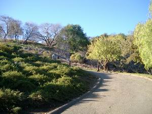
Access road to Acalanes Ridge Open Space from Camino Verde Circle.
This walk is a loop from the Camino Verde Circle entrance up to the top of Acalanes Ridge and on to the Sousa Drive entrance. The path returns to the Camino Verde Circle entrance. The moderately-strenuous walk takes about an hour and forty-five minutes. When you locate the access road at the top of Camino Verde Circle, park in the guest parking area and proceed up the road to the gate. Your starting elevation is 340 feet.
After you enter the gate, proceed up the now-unpaved access road past the entrance kiosk, which has a map of Acalanes Open Space. You will see a footpath diverge to the left. Take this path and go through the gate into an ungrazed area of the open space.
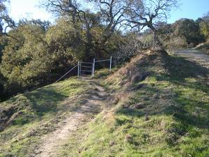
Footpath leading into the ungrazed area
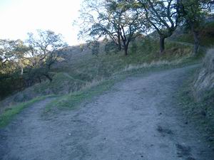
Continue on the footpath until you reach a gate and pass through into the grazed area, continuing uphill and back into wide-open meadows. Small oak trees can still be seen along the trail even after you re-enter the grazed area but these are at risk to damage by cattle. You will shortly come to a junction and cross an access road. Cross the access road and go uphill diagonally to the right. This route will take you to the ridgetop. Near the top of the hill you will go into a shaded mature oak woodland.
Go uphill to the left from the entrance kiosk
The path to the top of the ridge is strenuous but the views in all directions are rewarding. Look to the north and see the Sacramento River beyond the refineries in Martinez. To the west observe Mt. Diablo. Shell Ridge Open Space is the line of sawtooth-shaped hills at the base of the mountain. Lime Ridge Open Space can be seen to the north of the mountain -- Ygnacio Valley Rd. cuts through its heart. To the west you can see Las Trampas and Briones Open Space areas (EBRPD). At its peak, Acalanes Ridge has an elevation of 750 feet. Coming down the Ridge Trail you will reach a trail junction; take the footpath to the left.
At this junction, go either uphill or downhill. You'll end up in the same place!
At the end of this section af trail is a distinctive gate leading into East Bay Municipal Utility District territory. The best aspect of this junction is that both a water fountain and a rustic bench await the traveler. Bring a water bowl if your dog is with you. Continuing down the paved access road, you may hear hummingbirds as they feed on Eucalyptus flowers in trees on your right. Numerous conifers, Coast Live Oaks, and Bay Laurel surround you on the downhill path. During a major construction project lasting untill 2007, the rest of this trail is blocked below the Sousa Trail, which you now enter on the right.
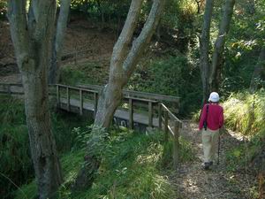
Bridge crossing over year-round creek on Sousa Trail
From the bridge, continue through oak and California Buckeye woodland to the end of Sousa Trail. Along the way, you might like to check side paths to the right, each of which has more interesting sights. Near the Sousa Drive gate, the trail opens to a vista of downtown Walnut Creek with Lime Ridge in the background. Finally you will reach the Sousa Gate. Your elevation is now 380 feet. Unless you have made other plans, turn around here and start back toward Camino Verde Circle. As you start, notice the Toyon and Coyote Bush along the side of the trail. In November and December, Coyote Bush is in bloom and Toyons are full of red berries - excellent food for migratory American Robins and Cedar Waxwings, among other species.
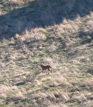
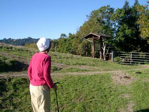
A coyote in Acalanes Ridge, just one of the many types of wildlife you might see
You will return through the ungrazed area you traversed at the beginning of the walk to the Camino Verde Circle entrance gate. We hope you enjoy the views, trails, and wildlife on Acalanes Ridge.
Bob and Cindy Brittain
November 23, 2003